


Bhutan is primarily an agriculture-based country, with 58% of the population earning incomes connected to the agricultural sector. Nearly all Bhutanese, including those pursuing non-farm livelihoods, have ties to agriculture through distinct food cultures, local economies, and eco-social networks. The agricultural sector, however, faces a complex array of challenges to which farmers actively respond, including: steep terrain, inaccessibility to markets, small landholdings, labor shortage, aging population, water scarcity, pests and diseases, human-wildlife conflicts, competition from cheap food imports, and increasingly impacts related to climate change. Our photo essay illuminates responses to these challenges at the local-scale by highlighting the practices and innovations of smallholder farmers to support food security in Pemagatshel Dzongkhag (translated as “district”). Pemagatshel is geographically remote and socio-economically on the margins, with approximately 26.9% of the population facing high rates of poverty (BLSS, 2017). Despite the indicators, this district has a rich history of agriculture and food production. Our observations and field data collected during 2022-2023 confirm examples of vibrant and adaptive strategies being utilized by mountain farmers. Our aim is to illustrate aspects of mountain farming systems and farmers’ lives, drawing attention to the Tshanglakha-speaking communities located in Chimong, Chongshing, and Yurung Gewogs (translated as “county”). Local farmers in this part of Bhutan are experimenting with various technologies and tools, including knowledge sharing activities, in their efforts to mitigate risks and enhance resilience within the agricultural sector.
The way to reach Pemagatshel Dzongkhag (27° 02' 16.62" N, 91° 24' 10.98" E) is by overland travel via Bhutan’s National Highway system. The East-West Highway traverses the distinctive Black Mountain Range and crosses the rivers Mangdue Chhu and Dragme Chhu. These rivers eventually converge to form the Manas River, which serves as a relatively small part of the political boundary between Bhutan and India. Rivers and other water bodies (e.g., alpine lakes, glaciers, marshes, springs, and streams) in Bhutan provide 70,576 cubic hectometers (hm3) of freshwater annually (Wangdi et al., 2018). Bhutan uses only 1% of the total available freshwater, of which 86% is used in agriculture (NEC, 2016). The abundance of water in the country has enabled hydropower projects to generate revenue through the sale of electricity to neighboring India. After hydropower and tourism, agriculture is the next major economic cornerstone, contributing about 14.67% to the Gross Domestic Product (NSB, 2023b).
Pemagatshel is more isolated than western districts of the country, in part, because of its inaccessibility and lack of infrastructure. Travel to this remote district is difficult and time-consuming because of the extreme mountainous terrain, narrow rough roads, and frequent road blockages caused by slope failures. Roads must cut across steep slopes marked by geomorphic instability, which is exacerbated by landslides, rock falls, heavy monsoon precipitation, and seismicity. These factors hinder access to communities and increase travel risks. Road construction and maintenance require huge investments in resources. As we can see here, work crews strive to get road repairs underway in advance of the monsoon season (officially from June to September).
The mountainous landscape is characterized by dense forests that are protected by rigorous environmental policies and a national system of biological corridors, parks and protected areas. Pemagatshel’s vast intact forests are comprised of mainly mixed coniferous and broadleaf species that cover 87.65 % of its total land area (1,023 square km) (Pemagatshel Dzongkhag Administration, 2022). Forest types vary depending upon the elevational gradients and include Eastern Himalayan lowland tropical forest and dry subtropical mixed forest. These forests provide vital habitat for wildlife such as the Golden Langur (Trachypithecus geei bhutanensis) featured here, which is one of the most endangered primate species in South Asia. The presence of other unique species reinforces Bhutan’s status as a global biodiversity hotspot.
Pemagatshel, which translates to the “Blissful Land of the Lotus,” is famous for its ancient pilgrimage heritage and sacred sites, such as Khahor Goenpa on the western edge of the district. This temple is located on an inspiring ridge with spectacular views of the surrounding valleys. The temple architecture conforms to a Nepalese-style structure and design (similar to Boudhanath Stupa in Kathmandu), reflecting the history of long-standing cultural exchange and interaction between south-eastern Bhutan and the greater Himalayan region.
This truck is delivering rice and wheat flour, two of the high- demand food commodities that come overland from India. Approximately 34% of cereal demands in the country are met through imports (FSAPP, 2021). The Government of Bhutan has prioritized the strengthening of local food systems in order to lessen these dependencies and to achieve greater food self-sufficiency. The COVID-19 pandemic created an unprecedented shock to the food situation in the country when borders were closed to trade in March 2020. Hence, food security has reached a heightened level of concern, which has motivated people to engage or re-engage in home gardening, farming, seed-saving practices, and climate-resilient agriculture.
Pemagatshel Dzongkhag has nearly 23,800 residents most of whom live in dispersed settlements between 445-3000 meters above sea level (NSB, 2023a). In our study sites located in Chimong, Chongshing, and Yurung Gewogs, arable land is scarce. The majority of farms are built on slopes, such as this one on slopes greater than 50 degrees. Terracing and other slope stabilization techniques to maximize arable land, reduce soil erosion and retain moisture are long-held Indigenous techniques to sustain farming and food production.
Visible here are fields in Chimong, an isolated village of 204 smallholder subsistence households with landholdings averaging 2-3.5 acres (0.81–1.42 hectares).
Looms for weaving are common features in farmholders’ living spaces in this district, which is famous throughout Bhutan for intricate and colorful textiles. One of the primary sources of income for women farmers throughout the year is the weaving of clothes and other textiles using cotton and silk threads. Some women farmers earn much more than their husbands through the sale of their weaving, thereby contributing a significant portion to the household economy. A very popular form of this handwork is thongsa kamthama, a type of woven cotton fabric.
Chimong is situated on a relatively level mountaintop at 1,300 meters above sea level, with the local school centrally located (visible in the foreground). The high dependency on agriculture for most smallholder families in Chimong and elsewhere in the district makes them especially vulnerable to environmental changes. Land degradation, soil erosion, soil fertility decline, and shifts in the onset or offset of the rainy season interact with or are exacerbated by climate change. The farmers we interviewed reported that climate change is affecting their agricultural production. They have observed changing rainfall patterns and seasonal drought and even the lake in the surrounding forest has permanently desiccated whilst others have decreased in size. Farmers also report experiencing high winds and hailstorms, erratic rains, and the arrival of new diseases and pests.
Maize is the most abundantly grown cereal crop across Pemagatshel. Harvested maize is dried in locally crafted driers such as this example fabricated out of wood, corrugated metal sheets and wire mesh. These storage shelters protect against wild animals that may destroy harvested corn if left unprotected. Farmers repeatedly reported incidences of new pests and diseases affecting maize. For instance, army worms (Mythimna separata) and fall armyworms (Spodoptera frugiperda) have infested huge areas of maize. These changing conditions pose a risk of crop losses and will compromise the food security of smallholder farmers. Bio-pesticides and integrated pest management practices are being adopted along with a plan to implement an early warning system for pest outbreaks.
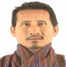
Mangme, in his 70s, is enthusiastic about sharing his knowledge and is a highly respected source of agriculture information. Bhutan has a progressive farmer training program informally initiated to recognize hardworking and innovative farmers such as Mangme. The Commercial Agriculture and Resilient Livelihoods Enhancement Programme (CARLEP), based in Mongar, eastern Bhutan, aims to facilitate the transformation of the subsistence rural agriculture economy by incorporating value chain and market-driven components. Farmers trained through the project are encouraging and guiding others in their respective communities following the CARLEP project’s capacity development approach. Pemagatshel is one of the six districts in eastern Bhutan that has benefited from the project.
Namgay Dema in Chongshing is an active saver of locally adapted heritage seeds, which were assumed by agriculture specialists in the country to be long abandoned. Farmers like her are largely self-reliant when it comes to conserving amaranths, millets, buckwheats, barleys, mustards and legumes, which they continue to cultivate for their own household consumption. Seed saving practices by farmers have been shown to boost community-scale climate adaptability and food security (Nazarea et al., 2013; Shiva, 2022; Zimmerer et al., 2023).
Featured here are various types of millets – foxtail millet, finger millet and little millet – along with corn and colorful varieties of legumes. The area is predominantly dryland, and the cultivation of rice is constrained unlike other areas of Bhutan. Heritage millets have low water needs and are grown in relatively small plots and in small quantities. The costs and benefits of millet cultivation have not been formally assessed; nevertheless, these pockets of diverse cereal production give hope towards reviving sustainable crops that are easy-to-grow, drought-tolerant, nutrient-dense, pest and disease-resistant, hardy, store well, and thrive in dryland agricultural conditions, including in drier conditions that farmers are now observing.
Farmers in Yurung are experimenting with the intercropping of peas and potatoes, a system that they learned from other farmers during a peer-to-peer workshop we hosted in 2022. This innovative practice is one of several climate-smart agricultural techniques to build resilience into their cropping system. The guiding concepts of climate-smart agriculture (FAO, 2021; CIAT & World Bank, 2017) are not entirely new to these farmers who have an established history of self-sufficiency, local experimentation, and adapting to change.
Chilis and ginger are widely grown for household consumption, with surplus sold as valuable cash crops. Other cash crops include passion fruits, turmeric, citrus, potatoes, leafy vegetables, pineapple, and more recently, cardamom and avocados. Based on historical accounts given by elders, increases in the production of these crops have been remarkable, especially in the varieties of vegetables and horticultural crops. The crop introductions are partly the result of government-supported programs and projects implemented by development organizations, including influential horticulture initiatives spearheaded by award winning Japanese horticulturalist Yuichi Tomiyasu with the Japan International Cooperation Agency.
New interventions on farms include drip irrigation and the use of 1,000-2,000 liter plastic water storage tanks. As farmers are increasingly facing water scarcity both for domestic and agricultural purposes, the local solution has been to invest in water storage and on-farm irrigation. Irrigation hoses are used to bring water to the terraced fields and for direct application of water on fruit orchards. The dearth of irrigation water affecting the agricultural sector is part of the changing conditions observed locally. Elderly farmers note that they used to have adequate water in the past and blame climate change for dried up water sources and increasing water scarcity. Farms are scattered and located far away from drainages and valley bottoms where irrigation water is plentiful. Large volumes of water flow off mountains into deep gorges, making it inaccessible for dispersed settlements on slopes with little to no irrigation infrastructure. Further, farmers have long depended on monsoon rains to irrigate their lands, yet monsoon rains are shifting, are less reliable and more irregular than in the past.
Crop residues and farmyard manure are being processed into new forms of organic locally-made biofertilizers and biopesticides. Leaf litter collected from the nearby forests as well as cattle manure and urine are being processed into organic biofertilizers that are applied on fields to boost the fertility of soils. Leaf litter is collected during winter when farm activities and demands have decreased.
In addition to enriching soils and reducing erosion, farmers have also been experimenting with ways to create bio-pesticides prepared using locally available plant and animal-based products to protect crops and vegetables from pests.
A polyhouse (greenhouse made from sheets of plastic) is one of a set of widely adopted low-cost technologies on Pemagatshel farms. Polyhouses facilitate vegetables and fruit production during winter months as well as protect from pests and heavy rainfall.
Porcupines, deer, wild boar, and monkeys regularly destroy crops and harvests in this buffer zone of human-forest-wildlife encounters. As a result, farming is a twenty-four hour occupation in this district, entailing fieldwork by day and guarding fields by night. Farmers spend their nights in guard towers from where they surveil fields and scare away wild animals.
In the village of Thungo, the Himalayan crestless porcupine (Hystrix bracyhura), easily identified by its spines, are particularly avid crop raiders. Farmers attempt to mitigate destructive wildlife behavior with scarecrows; various types of stone, fabric, electric or wooden fencing; and green nets.
Local cattle such as Himalayan breeds known as Jatsha-Jatsam, Yangku-Yangkum, Doethra-Doethram, and Jaba play a vital role in these mixed smallholder farming systems. Livestock provide manure as a source of fertilizer and animal traction for plowing fields. Dairy farming is a dominant activity, and nearly all households have some cows. Except for a few families, most farmers have transitioned out of pig, poultry and fish farming due to strong religious sentiments and a more recent ethical and moral turn away from killing animals.
As a mountainous area, most agricultural lands are on rugged terrain, which limits the mechanization of many farm activities. Few farmers in the study area have access to or own farm machinery and equipment. Only selected machinery and equipment such as power tillers, mini-tractors, mini power tillers, and hand tools are used. Farmers see some mechanization that is appropriate for this unique geographical terrain as having huge potential to address the labor shortage, enhance farm efficiency and upscale agricultural production.
Abandoned stone and mud brick houses such as this one are common. Abandoned farmhouses are known locally as gungtongs or “empty houses.” Personal communication with local residents and the agricultural field supervisor along with our resource mapping study indicate that in some villages in the Yurung Gewog up to 50% of the population has moved out and relocated to larger towns in distant areas, even in western Bhutan. This phenomenon has three interconnected consequences: the rural labor force is reduced; community vitality and cultural heritage become difficult to maintain; and people’s involvement in local food and agricultural systems are weakened. Several processes - the out-migration of young people, an ageing rural population and an expanding urban population not contributing to food production – are expected to further strain the future productive capacity of the agriculture sector in Bhutan. In the absence of more visible and frequent human activity on the land, wildlife damage to crops has been on the increase.
Even in the remote eastern districts, farmers adopt a variety of digital, online and mobile phone communications to support market transactions. Some farmers use SMS via mobile phones to digitally market their agricultural produce and to communicate market and price updates to their networks. Vegetable sales via mobile banking, pictured here, are widespread given that internet connectivity is reliable even in relatively out-of-the-way valleys. Farmers also continue to rely on conventional television and radio broadcasts to receive updates about agricultural markets and auctions for cash crops bound for export to India.
This truck is among a fleet that is delivering tree saplings to Pemagatshel and the other 19 districts in Bhutan as part of His Majesty’s One Million Fruit Trees Plantation Project. The first phase of tree sapling distribution was initiated in March 2022. The second phase of the project in Pemagatshel was launched on 21 February 2023 to coincide with the 43rd Birth Anniversary of the King of Bhutan. This project is another example of resilience-minded support for mountain farmers as high-value trees will help diversify not just the income sources but also enhance the nutritional diversity, food security and produce available for consumers. The tree products can also be used for traditional festivals and ceremonial purposes, thereby reducing the dependence on the import of expensive fruits and nuts from outside of Bhutan. The thirteen varieties include nut trees (almond, walnut, macadamia, pecan), fruit trees (kiwi, avocado, dragon, Irwin mango, mandarin, seedless lime, soursop, coconut), and a fragrant resinous hardwood (agarwood). The trees are distributed free of cost to interested farmers and are geo-tagged for management and monitoring purposes. Youth volunteers (known as “DeSuups”) have been dispatched across the country to assist with the planting of these tree saplings.
The complex agro-ecological zones and micro-climates in Bhutan make it possible to grow diverse cereals, legumes, fruits, and vegetables. These agro-ecological systems, in turn, influence vibrant and nourishing food cultures, as the “Food Map of Bhutan” illustrates (Tshering and Norbu, 2020). While doing fieldwork, we found the commitment and pride of local farmers to sustaining these systems was visible in myriad farmer-led efforts to address context-specific challenges within the agricultural sector. We learned that resilience strategies often unfold at the micro-scale, as in the case of one women farmer saving previously undocumented heritage seed. Similarly, at the community-scale Pemagatshel’s farmers are mobilizing an array of climate-smart technologies and farming practices, thereby marshalling memories of resilience and reinforcing collective capacities and adaptation to change.
We gratefully acknowledge the Partnerships for Enhanced Engagement in Research (PEER) program (cooperative agreement # AID-OAA-A-11-00012), facilitated by the United States Agency for International Development (USAID), for the generous funding support. We also thank the National Academies of Sciences, Engineering and Medicine (NAS) and the Bhutan Foundation for support of our work. We wish to express our deepest gratitude to the Pemagatshel Dzongkhag administrators, rural extension agents, field assistants, local guides and translators for their contributions. We would also like to extend our profound thanks to the farmers for sparing their time to provide valuable information and for sharing tremendous generosity and warm hospitality during our field visits. The institutional and administrative support provided by the College of Natural Resources, Royal University of Bhutan, and the W.A. Franke College of Forestry and Conservation, University of Montana is greatly appreciated. Our gratitude is also extended to Dr. Mai Kobayashi of Kyoto University and the anonymous reviewers for thoughtful feedback and suggestions on a previous version of this article.
All images in this photo essay were taken by Dr. Sarah J. Halvorson in March 2023. Individuals pictured have provided consent for the use of their image. Permission to include the “Food Map of Bhutan” has kindly been provided by Sonam Tshering and Jigme Norbu of the Royal Institute of Tourism and Hospitality, Ministry of Education and Skills Development.